
A privately built lunar lander is targeting a near‑polar site to hunt for water ice and prove night survival. Engineers designed the mission to gather resources, knowledge, and demonstrate rugged operations in extreme cold. The plan couples scientific measurements with practical technologies needed for long‑term surface presence. Those dual goals make the landing both ambitious and consequential for future explorers.
Mission objectives and strategic value
The mission pursues two clear objectives. First, it seeks direct evidence of accessible water ice near the surface. Second, it tests hardware and procedures to endure a two‑week lunar night. These aims support exploration architectures that use local resources rather than constant resupply. Together, they reduce risk for future crewed and robotic operations.
Water ice matters because it can supply life support, propellant, and radiation shielding. Converting ice into oxygen and hydrogen lowers launch mass for deep‑space missions. Demonstrating survival also enables longer science campaigns with modest power budgets. That capability unlocks continuous operations at promising polar sites.
Why a near‑polar landing zone?
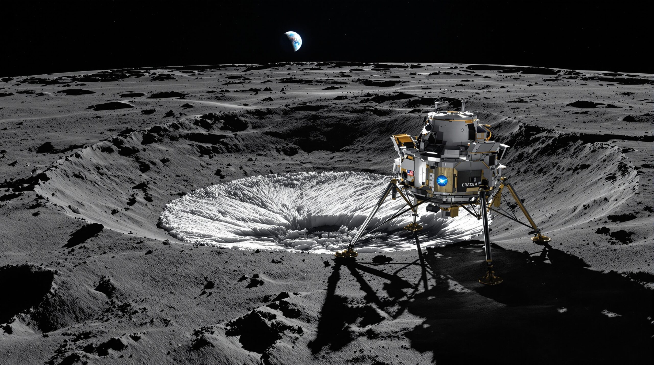
The lunar poles offer unique resources and unique challenges. Orbital data show hydrogen enhancements inside permanently shadowed regions, or PSRs. These PSRs remain sunless and extremely cold, allowing ice to accumulate over geologic time. However, their darkness complicates landing, power generation, and navigation.
Near‑polar ridges and crater rims receive grazing sunlight for extended periods. Those areas can host landers with solar power and direct Earth visibility. They also provide proximity to PSRs for scientific scouting. This geometry motivates a landing just outside permanently shadowed interiors.
Site selection and descent considerations
Mission planners analyze terrain slopes, boulder fields, and lighting conditions at candidate sites. They also model communications windows to ground stations. The team favors smooth plains near PSR boundaries and stable thermal conditions. That balance enables safe descent while preserving science access.
Hazard detection and terrain relative navigation help guide the lander. Cameras and LIDAR compare surface features to preloaded maps. The system autonomously diverts from steep slopes and large boulders. Those capabilities improve touchdown odds at low sun angles.
Science questions driving the payload
The payload focuses on three questions. Where is ice located within the near‑surface regolith. How stable are volatiles under current polar conditions. What engineering environments will future systems experience at similar sites.
To answer these questions, the mission combines subsurface sampling, volatile sensing, and environmental monitoring. The instruments emphasize ground truth to validate decades of orbital data. This approach supports both science and resource assessment. It also informs design margins for later missions.
Subsurface access and sample handling
A compact drill targets depths where ice could persist. Engineers limit drill power to fit a small lander platform. The system collects regolith cuttings and delivers them to miniature ovens. These ovens heat samples and release trapped volatiles for analysis.
Careful handling prevents loss of delicate ices during transfer. Thermal isolation and short pathways reduce warming of collected material. Operators coordinate drilling during cooler local times when possible. This strategy maximizes the chances of detecting intact volatiles.
Volatile detection techniques
A mass spectrometer measures gases released from heated samples. It looks for water and companion molecules like carbon monoxide and ammonia. A neutron spectrometer surveys hydrogen abundance around the lander. Together, those instruments triangulate the presence and concentration of buried ice.
Infrared spectrometers can also map frost at the surface. They search for diagnostic absorption features in reflected sunlight. Such instruments require careful calibration under low sun angles. Their readings complement the subsurface measurements from drilling.
Environmental and geotechnical monitoring
Thermal probes record temperature profiles in the regolith. They reveal how heat flows around potential ice deposits. The lander also tracks surface pressure, radiation, and dust activity. Those data feed models of volatile stability and hardware reliability.
Geotechnical sensors estimate bearing strength and particle size distribution. They help future missions design wheels, drills, and anchors. Combining mechanical and thermal measurements clarifies regolith behavior near PSRs. This knowledge reduces design uncertainty for subsequent landings.
Surviving the two‑week lunar night
Night survival is the mission’s bold technology demonstration. Without sunlight, temperatures plunge far below typical electronics limits. The team employs layered insulation, heaters, and low‑temperature components. These measures keep critical systems above survival thresholds.
Energy storage defines the night strategy. Batteries charge during the preceding daylight period. The lander reduces activity to essential thermal control and health monitoring. Smart power management stretches available energy through the dark interval.
Some missions use radioisotope heater units for added warmth. However, regulatory and supply factors complicate private access to such heaters. This lander emphasizes passive insulation and efficient electrical heating. That approach focuses on systems accessible to commercial operators.
Software plays a major role in survival. Engineers script autonomous hibernation modes with periodic check‑ins. The lander selects heaters based on real‑time temperature sensors. It also throttles communications to preserve battery life.
Operations plan across day and night
During the first lunar day, the team prioritizes landing validation and instrument commissioning. Drilling and volatile analysis follow during favorable thermal windows. The lander caches data to guard against communications gaps. Operators then configure hibernation before sunset.
After sunrise, the lander attempts wake‑up and systems checks. If successful, it resumes science with revised priorities. The team compares pre‑night and post‑night measurements. That comparison illuminates transient changes in the local volatile environment.
Communications and navigation at the poles
Near‑polar geometry constrains Earth visibility. The lander carries high‑gain and low‑gain antennas for flexibility. It schedules contacts when line of sight opens. Star trackers and Sun sensors aid inertial navigation under low illumination.
Orbiters can provide backup relay options if available. However, the mission plans for direct‑to‑Earth links as primary. That choice simplifies operations and reduces reliance on third‑party assets. It also drives strict site selection criteria.
Commercial context and partnerships
The mission aligns with growing public‑private partnerships for lunar services. Programs like NASA’s Commercial Lunar Payload Services encourage such efforts. Government customers provide instruments and data buys. Private providers supply the lander, integration, and mission operations.
This model spreads risk and accelerates learning. It also builds a marketplace for repeated polar deliveries. As companies gain experience, costs can drop and reliability can improve. Those trends benefit science and exploration stakeholders alike.
Key risks and mitigation strategies
Landing hazards remain the primary risk driver. Detailed terrain modeling and autonomous hazard avoidance address that threat. Thermal extremes pose the second major risk. Materials testing and redundant heaters mitigate cold‑induced failures.
Drilling introduces mechanical uncertainty in unknown regolith. The team limits torque and monitors vibration closely. They also plan incremental depth targets and contingency stops. Careful procedures protect both the drill and the lander.
Expected results and measurements
The mission expects to produce hydrogen maps at the local scale. It also aims to measure water release from heated samples. Thermal profiles will quantify regolith conductivity and heat capacity. These results inform models of ice stability and distribution.
Operationally, the lander will generate a detailed night survival log. Engineers will correlate heater duty cycles with environmental readings. That record will guide future power and insulation budgets. It will also shape component qualification standards for polar missions.
Implications for future explorers
Successful night survival would mark a pivotal milestone for private lunar systems. It demonstrates endurance without exotic power sources. Reliable polar operations enable resource prospecting, construction, and science outposts. Those capabilities support sustained human activity beyond low Earth orbit.
Validated ice detection techniques will also accelerate resource mapping. Future missions can concentrate on the most promising deposits. That focus optimizes drilling campaigns and infrastructure placement. It also improves the economics of in‑situ resource utilization.
How this mission advances lunar science
Ground truth strengthens interpretations from orbital spectrometers and neutron detectors. LCROSS and orbital missions highlighted polar volatiles years ago. Local measurements now test those conclusions at human scales. The results feed improved models of lunar volatile cycles.
Environmental data also refine landing and operations forecasts. Dust, temperature, and radiation readings calibrate engineering assumptions. Such calibration reduces design conservatism and mass. That efficiency frees payload capacity for additional science instruments.
Looking ahead to a new polar era
Private lunar landers are expanding access to challenging sites. Each attempt yields lessons that strengthen the next mission. Polar landings will become routine as techniques mature. With persistence, commercial providers will enable sustained polar exploration.
This mission aims to prove two critical building blocks. It targets accessible water ice and demonstrates night survival on a modest platform. Those achievements would echo across upcoming campaigns. They would help turn polar concepts into practical operations.
Conclusion
A near‑polar touchdown that scouts for ice and survives the night advances science and sustainability together. The approach marries resource prospecting with durable engineering. If successful, it will reshape what private missions can accomplish at the Moon’s poles.