
Scientists have mapped a massive freshwater reservoir hidden beneath Antarctic ice. The discovery reveals a region-spanning aquifer saturating deep sediments under key ice streams. The reservoir stores water that moves and drains on timescales relevant to ice flow. This mapped system connects known subglacial lakes with porous, water-rich sediments. The combination forms a dynamic, continent-scale hydrologic network. These results shift how researchers evaluate future sea-level rise and ice-sheet stability.
Anatomy of the Hidden Reservoir
The mapped reservoir lies below grounded ice, not beneath floating ice shelves. It occupies thick sedimentary basins carved by ancient glaciers. Water saturates these sediments from near the bed to great depths. The reservoir likely spans hundreds of kilometers in some places. It appears interconnected with subglacial lakes and distributed drainage pathways. This configuration allows water to redistribute quickly when pressure gradients shift.
Glacial meltwater supplies the reservoir through pressure-driven flow at the ice base. Geothermal heat and frictional heating produce basal meltwater year-round. Ancient meteoric water may contribute within deep sediments. The aquifer holds freshwater with varying mineral content and temperature. Water pressure within the reservoir influences how the overlying ice slides. That sliding behavior controls how fast ice funnels toward the ocean.
Tools That Revealed the Water
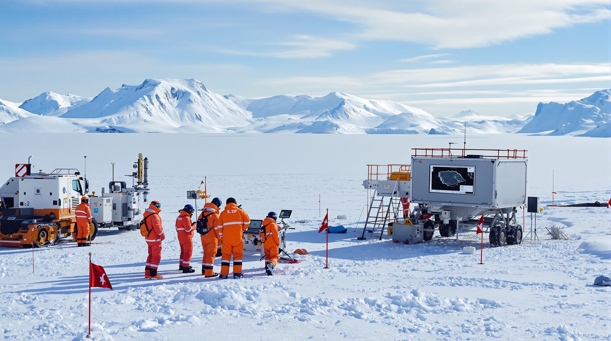
Scientists combined several geophysical tools to map this hidden system. Ice-penetrating radar traced layer geometry and basal reflectivity. Strong basal reflections often mark wet, smooth beds. Weaker reflections signal rough or frozen interfaces. Radar alone cannot resolve deep groundwater, however. Researchers therefore added complementary methods to illuminate the full aquifer.
Magnetotelluric soundings measured subsurface electrical resistivity beneath the ice. Freshwater-saturated sediments appear more conductive than dry or frozen materials. These measurements indicate thick zones of water-rich sediments beneath major ice streams. Active and passive seismic surveys further constrained sediment thickness and porosity. Seismic velocities and reflections revealed soft, deformable layers beneath the ice base. Together, the methods outline a deep, widespread hydrologic body.
Satellite altimetry added time-varying context to the static maps. Small surface elevation changes indicated water movement within linked lakes and channels. GPS velocity records captured changes in ice speed related to basal lubrication. Gravimetry data offered mass change constraints at regional scales. These datasets helped connect structure to active hydrologic behavior. The synthesis created a coherent picture of reservoir extent and dynamics.
Why the Discovery Matters for Sea-Level Rise
Basal water regulates friction at the ice-bed interface. More water generally reduces friction and promotes faster sliding. The reservoir can feed surge-like behavior when pressures rise. Fast sliding accelerates ice discharge into the ocean. Increased discharge directly raises global sea levels. This mechanism demands updated models of how water controls ice dynamics.
The reservoir also influences grounding lines, where ice detaches from bedrock and floats. Subglacial discharge can warm and freshen ocean water beneath ice shelves. That combination can enhance melting at the ice-shelf base. Reduced shelf thickness weakens buttressing that restrains inland ice. Grounding lines may then retreat into deeper basins. Retreat can trigger feedbacks that increase sea-level contributions.
Integrating the Reservoir into Models
Ice-sheet models need realistic subglacial hydrology to capture observed behavior. The mapped reservoir provides physical parameters for that hydrology. Models can now include aquifer thickness, porosity, and hydraulic connectivity. They can simulate pressure-dependent sliding with more confidence. Coupled models can also track water routing and heat transport. These improvements should tighten projections of sea-level rise.
Timescales matter for both hazards and policy. Water moves within days through channels and months within lakes. Groundwater in deep sediments can evolve over years to decades. Ice-dynamic responses can therefore unfold across multiple timescales. Models must represent these timescales without excessive computational cost. That balance will determine the realism of future projections.
Regional Contrasts and Comparisons
West Antarctica hosts fast ice streams draining into vulnerable ice shelves. There, deep sediments and high basal heat favor extensive groundwater. East Antarctica contains older, colder ice over stable cratons. Yet important basins also exist beneath parts of East Antarctica. Subglacial lakes like Vostok highlight long-lived water storage in the east. The new reservoir mapping connects both regions into a holistic hydrologic framework.
Past studies revealed dynamic lakes beneath West Antarctic ice streams. Those studies documented lake filling, drainage, and linked flow events. The new work extends that view downward into deep sediments. It shows how lakes and groundwater interact beneath thick ice. That interaction can either buffer or amplify drainage events. The regional perspective strengthens process understanding across the continent.
Consequences for Ice Shelves and Oceans
Subglacial discharge affects coastal ocean circulation and stratification. Freshwater plumes can trap heat against ice-shelf bases. That heat can increase basal melt rates under key shelves. Melt-driven thinning reduces buttressing forces that slow inland ice flow. The reservoir adds a persistent freshwater source to those coastal zones. This connection reinforces the need for coupled ice-ocean modeling.
What Could Happen Next
Hydrologic systems evolve as climate forcing changes. Warming oceans and atmosphere can increase basal meltwater production. Reservoir pressures may rise as inflows exceed outflows. That pressure can reorganize drainage pathways and trigger rapid drainage. Downstream ice streams may accelerate during such reorganizations. These episodes can deliver pulses of ice to the sea.
Conversely, expanded channel networks can lower basal water pressure. Lower pressures raise friction and slow sliding for a period. The reservoir therefore introduces stabilizing and destabilizing possibilities. The net outcome depends on geometry and forcing patterns. Monitoring will reveal which pathways dominate under ongoing warming. Adaptive models must include both possibilities to remain credible.
Limits, Uncertainties, and Open Questions
Geophysical inversions do not produce unique solutions. Conductivity and seismic velocity can reflect multiple material combinations. Porosity and permeability estimates remain uncertain without direct sampling. Water salinity and temperature vary across basins. Temporal changes in groundwater pressure are hard to capture. These uncertainties define priorities for future field campaigns.
Spatial coverage remains uneven across Antarctica. Harsh logistics constrain instrument deployments in remote interior regions. Ice-sheet roughness degrades some radar signals near mountainous areas. Seasonal and interannual variability requires repeated measurements. Cross-validation among methods reduces bias in map products. Improved coverage will refine the reservoir’s boundaries and properties.
The Path Forward for Science and Policy
Researchers plan targeted boreholes to directly sample basal sediments and water. Fiber-optic cables can record distributed temperature and strain near the bed. Autonomous seismic nodes can track evolving drainage networks. Ocean moorings can measure sub-ice-shelf freshwater fluxes. Aircraft and satellite campaigns will extend mapping over data gaps. These efforts will validate and improve integrated models.
Policy makers need updated risk assessments that include hydrologic feedbacks. Coastal planning must consider revised sea-level rise scenarios and ranges. Insurance and infrastructure sectors require credible timelines for potential acceleration. International coordination can support sustained Antarctic observing systems. Data sharing will speed improvements to operational projections. Timely science can guide resilient decisions for vulnerable coasts.
Key Takeaways
The mapped subglacial reservoir changes our understanding of ice-sheet mechanics. It shows that Antarctica stores and moves vast freshwater beneath the ice. That water modulates friction, grounding lines, and ice-shelf melt rates. Those processes drive sea-level change on policy-relevant timescales. Incorporating this reservoir into models will refine future projections. Continued observations will keep those projections anchored to evolving reality.
This discovery highlights the deep coupling of ice, water, and ocean systems. It underscores the urgency of sustained Antarctic monitoring and model development. It also offers an opportunity for earlier warning of destabilizing events. Better hydrologic knowledge can inform smarter coastal planning worldwide. The science now points toward integrated, interdisciplinary approaches. Those approaches will shape the next generation of sea-level predictions.