

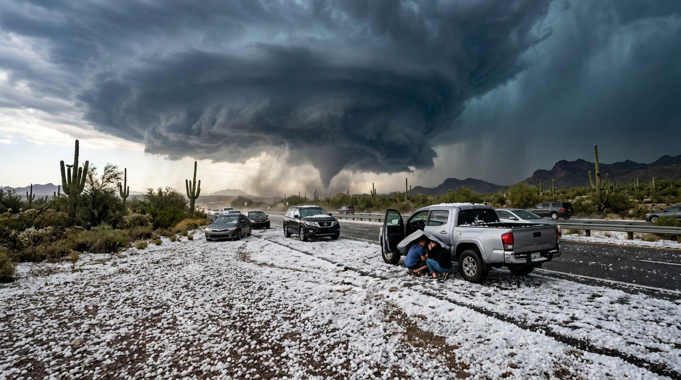
Arizona residents usually prepare for extreme heat, dust storms, flash flooding, and wildfires. A powerful storm system added unusually severe hazards. Strong thunderstorms brought golf-ball-sized hail, damaging winds, frequent lightning, and localized flooding. Forecasters also warned that several storms could produce tornadoes. That combination created a significant weather threat across affected communities.
The severe conditions developed as colder air moved over warm, moisture-rich air near the surface. Strong winds also changed speed and direction with altitude. This wind shear allowed thunderstorms to organize and rotate. Although severe storms occur in Arizona, this combination remains uncommon enough to attract widespread attention.
An Unusual Atmospheric Setup
The storm drew energy from contrasting air masses over the Southwest. Moisture supplied developing clouds with water, while cold air increased atmospheric instability. Rising parcels remained warmer than their surroundings, allowing them to climb rapidly. Those forceful updrafts supported towering thunderstorms capable of producing large hail.
A strong upper-level disturbance provided additional lift and helped organize the storm system. Faster winds several miles above Arizona strengthened the vertical wind shear. Consequently, individual thunderstorms could survive longer than typical afternoon storms. Some cells displayed characteristics associated with supercells, including persistent rotation and separated updrafts.
Arizona’s Terrain Complicates Storm Development
Arizona’s varied landscape can influence storm movement, rainfall, and wind. Mountains force moist air upward, sometimes strengthening thunderstorms near higher terrain. Valleys may channel strong gusts toward populated areas. However, dry lower-level air can weaken storms or produce sudden downbursts. These competing influences make local forecasting especially difficult.
Radar coverage also faces challenges around mountains and distant rural areas. Terrain can block lower radar beams, hiding important circulation near the ground. Meteorologists therefore compare radar data with satellite imagery, surface observations, lightning information, and public reports. That combined evidence helps forecasters identify rapidly changing hazards.
Golf-Ball-Sized Hail Raises Damage Concerns
Golf-ball-sized hail measures about 1.75 inches across, according to National Weather Service comparisons. That diameter greatly exceeds the one-inch threshold for severe hail. Stones of this size can dent vehicles, crack windshields, break skylights, and damage roofs. They may also injure people and animals caught outdoors.
Large hail forms inside powerful thunderstorm updrafts. Those updrafts carry ice particles through regions containing supercooled liquid water. Water freezes onto each particle, adding new layers of ice. The hailstone eventually falls when gravity overcomes the updraft. Stronger updrafts can support larger and heavier stones.
Arizona properties face particular hail vulnerabilities because many structures use exposed roofing materials. Solar panels, outdoor cooling equipment, and lightweight patio covers may also sustain damage. Meanwhile, agricultural areas can lose fruit, vegetables, and young plants within minutes. Livestock without shelter face injury from hail and windblown debris.
Tornado Risk Accompanies Rotating Storms
The same wind shear supporting organized thunderstorms can also create rotation. A rotating updraft, called a mesocyclone, may develop inside a supercell. Some mesocyclones produce tornadoes when circulation tightens near the surface. However, many rotating storms never generate a tornado. Forecasters must monitor each circulation closely as conditions evolve.
Arizona records fewer tornadoes than states across the central Plains and Southeast. Nevertheless, tornadoes can occur during several seasons. Pacific storm systems sometimes create favorable spring conditions, while monsoon thunderstorms can produce brief summer tornadoes. Landspouts may also form beneath developing clouds without a traditional rotating supercell.
Most Arizona tornadoes remain relatively weak and short-lived, but even weak tornadoes can cause serious damage. Roofs, manufactured homes, trees, power lines, and unsecured objects face considerable risks. Mountainous terrain does not prevent tornado formation. Tornadoes can cross hills, valleys, rivers, and developed neighborhoods.
Warnings Require Immediate Attention
A tornado watch means atmospheric conditions could support tornadoes within a broad region. A tornado warning signals a more immediate danger. Forecasters issue warnings when radar indicates rotation or observers report a tornado. Residents should not wait for visible confirmation because rain, darkness, or terrain may hide circulation.
Severe thunderstorm warnings also deserve attention during this event. The National Weather Service issues them for qualifying hail or damaging winds. Some severe storms can produce tornadoes with little advance notice. Therefore, people should treat every warning seriously and monitor reliable updates throughout the storm period.
Flooding and Strong Winds Add Hazards
Large hail and tornadoes represent only part of the danger. Thunderstorms can release intense rainfall over small areas, quickly overwhelming drainage systems. Water may collect on streets, underpasses, and desert roads. Normally dry washes can rise rapidly, even when rain falls several miles upstream.
Drivers should never enter a flooded roadway because water can hide damage or strong currents. Arizona officials regularly emphasize the “Turn Around, Don’t Drown” message. Only six inches of moving water can knock down an adult. Deeper water can move vehicles and trap occupants far from safe ground.
Thunderstorm winds can cause damage beyond the hail core. Downbursts send air rapidly toward the ground before spreading outward. These winds can topple trees, remove roofing, and disrupt electrical service. Blowing dust may sharply reduce visibility along highways. Power outages can also disable traffic signals and cooling systems.
Communities Prepare for Rapid Changes
Emergency managers rely on forecasts to position resources and inform vulnerable communities. Schools, airports, outdoor venues, and construction sites may adjust operations before storms arrive. Utility crews can prepare equipment for possible outages. Meanwhile, transportation agencies monitor flooded roads, fallen debris, and reduced visibility.
Residents can reduce hail damage by parking vehicles inside garages or beneath sturdy covers. They should secure patio furniture, trash containers, and other loose objects. However, nobody should move property after hail begins. Large stones can cause head injuries, while lightning may strike beyond the heaviest rainfall.
People in sturdy buildings should move to a small interior room during a tornado warning. A basement provides the best protection when available. Otherwise, residents should choose the lowest floor and avoid windows. Helmets, shoes, blankets, and mattresses can protect against flying debris and broken glass.
Manufactured homes offer limited protection from tornadoes and extreme winds. Occupants should identify a nearby shelter before storms develop. Vehicles and highway overpasses also provide poor tornado protection. Drivers should reach a secure building when possible, without blocking roads or outrunning dangerous circulation.
Reliable Information Becomes Essential
Weather conditions can change quickly during organized severe storms. Residents should enable emergency alerts and keep phones charged. A battery-powered weather radio provides information when cellular networks or electricity fail. Local National Weather Service offices offer warnings, radar updates, and detailed timing information.
Social media can spread useful reports, but it can also circulate outdated images and false claims. People should verify information through official agencies and established news organizations. Warning boundaries often cover only portions of large Arizona counties. Users should check maps and location details rather than relying on county names alone.
Recovery Continues After Skies Clear
Storm dangers can remain after the final thunderclap. Fallen power lines, unstable trees, broken glass, and flooded roads may threaten residents. People should report electrical hazards and avoid damaged areas. Property owners should photograph losses before making temporary repairs, provided conditions remain safe.
The event highlights Arizona’s ability to experience severe weather beyond familiar heat and monsoon hazards. Rare does not mean impossible, especially when moisture, instability, lift, and wind shear align. Careful preparation, trusted warnings, and immediate sheltering can reduce injuries. Those actions remain vital whenever Arizona’s weather turns unexpectedly violent.
